How to Map Lake Drainage Areas for Your HOA
The source of a recurring lake problem may be several streets away from the shoreline. Mapping lake drainage areas helps your HOA identify where runoff starts, how it travels, and which retention pond receives it.
A useful map combines approved drainage records with field-verified connections , rather than drawing boundaries around nearby homes. For gated communities, golf courses, and multi-lake properties, the process starts with understanding each lake's role in the stormwater system.
Understand What Lake Drainage Areas Include
A lake's drainage area is the land that sends runoff into that waterbody. It can include lawns, roofs, streets, parking lots, fairways, and land outside the community.
The shoreline and the drainage boundary are different features. A lake's surface acreage describes its water footprint. Its contributing drainage acreage describes the area supplying runoff.
Underground pipes also complicate the picture. Although a lawn may slope toward one lake, a nearby storm drain may carry street runoff to another.
Connected lakes need extra attention because an upstream pond can discharge into a downstream basin. Record both the land draining directly to each lake and any upstream contributions.
Also confirm each pond's stormwater function. Community names such as "retention pond" don't always match the approved design. Drainage plans and permit documents provide the better reference.
Assemble Records and Identify Every Lake
Start with the property's existing documents before drawing new drainage boundaries. Then organize them around consistent lake names.
Collect Plans, Permits, and Drainage Records
Request approved drainage plans, as-built drawings, plats, stormwater permits, and operation and maintenance documents. The property manager, developer, civil engineer, local government, or applicable water management district may hold copies.
Look for drainage basin boundaries, grading elevations, pipe routes, control structures, and discharge locations. Keep revised plans alongside earlier versions so changes remain traceable.
For help interpreting those features, review reading community lake as-built plans before transferring information to your working map.
Record the source and date of each document. An older drawing remains useful, but landscaping, construction, or repairs may have changed field conditions.
Build a Consistent Lake Inventory
Mark every retention pond and community lake on an aerial image or site plan. Give each waterbody a short identifier, then use it on inspection reports, photographs, invoices, and work orders.
Include small basins behind buildings, along cart paths, or between development phases. Missing one pond can leave an upstream connection unexplained.
A community lake asset inventory helps keep these features organized across a multi-lake property.
Create a profile for each basin with known acreage, usual water level, shoreline condition, and available depth information. Also record littoral shelves, fountains, aerators, and shoreline access points for maintenance planning.
Trace Runoff Paths Before Drawing Boundaries
Map the routes water follows first. Those routes provide the evidence for assigning land to a receiving lake.
Follow Slopes, Swales, and Surface Flow
Use grading plans and available elevation information to locate high ground, low points, and drainage divides. A divide separates land draining toward different receiving waters.
Trace swales, roadside gutters, fairway depressions, and other visible routes toward their receiving inlet or shoreline. Don't assume the closest lake receives the runoff.
Mark nearby construction and landscaping areas because exposed soil can enter the system through these routes. Also identify roof drainage where plans or field observations establish its destination.
Where contours or grading information are missing, leave the boundary provisional. An aerial photograph shows surface features, but it doesn't establish subtle changes in ground elevation.
Connect Inlets, Pipes, and Downstream Lakes
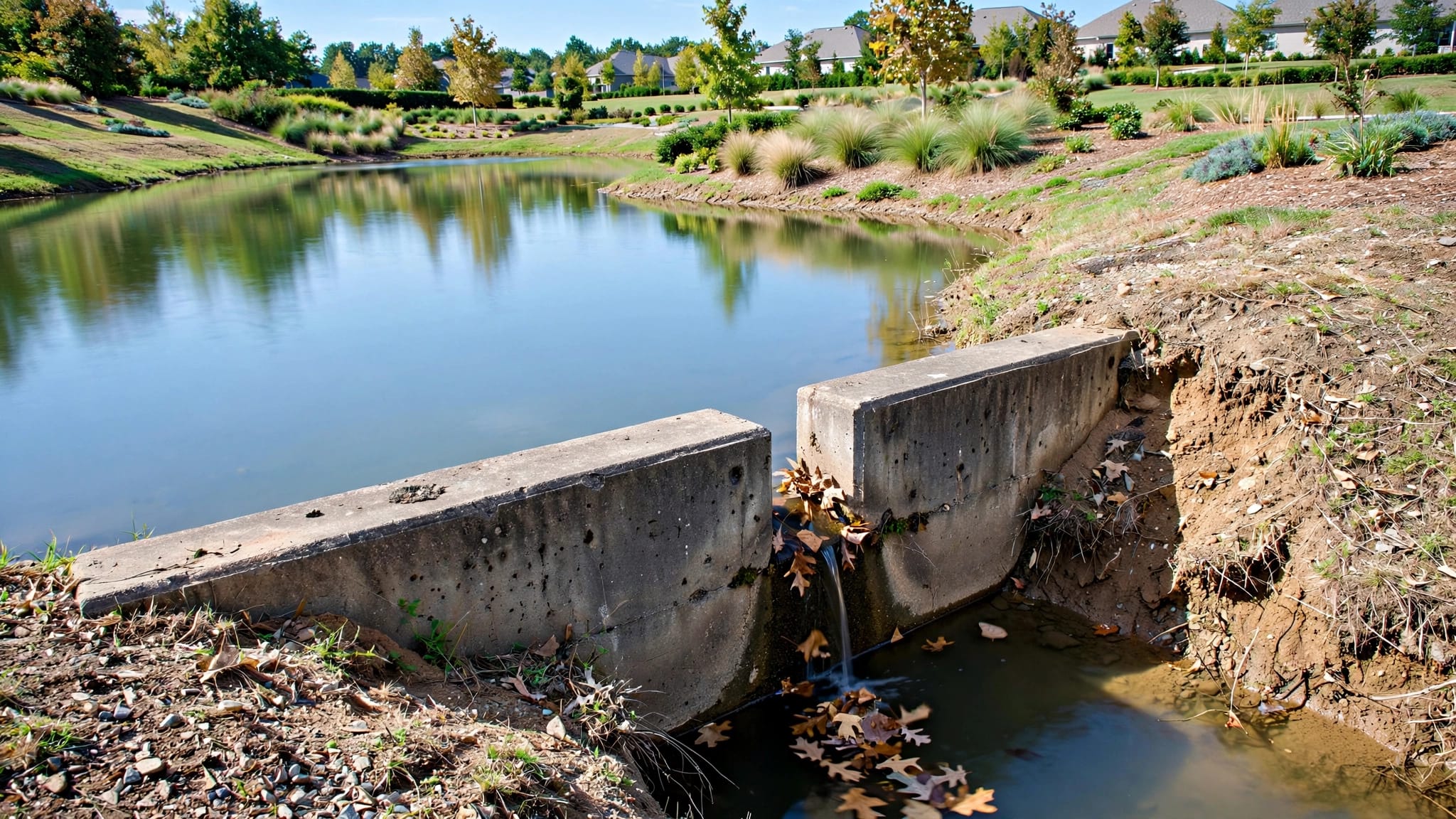
Locate stormwater inlets, culverts, pipe outlets, weirs, spillways, and emergency overflow routes. Give structures identifiers that connect them to photographs and inspection notes.
Then trace each inlet through the documented pipe network to its receiving lake. Show flow direction with clearly labeled lines or conventional map symbols.
Continue downstream through connected ponds until you identify the system's discharge point. However, distinguish ordinary drainage routes from emergency overflow paths.
A connection may carry water differently when lake levels rise. If pipe elevations or outlet operation remain unclear, flag the connection for engineering review rather than assigning a confident direction.
Verify the Drainage Map on the Property
Paper records establish a starting point. Site inspections reveal missing structures, changed grades, and conditions that affect actual runoff.
Inspect During Dry Conditions
Walk accessible drainage routes with the working map and take labeled photographs. Check whether inlets, swales, culverts, and shoreline outlets match the plans.
Look for sediment fans, eroded channels, blocked openings, grass clippings, and debris deposits. These clues can identify runoff pathways, although they don't establish flow under every storm condition.
Include lake control structure inspections when reviewing outlets, weirs, and overflow features.
Record discrepancies as open questions. Staff should never enter pipes or confined structures, and inspections shouldn't require approaching unstable banks or opening structures without qualified personnel.
Observe After Rain When Conditions Are Safe
A follow-up visit after rainfall can reveal routes that remain invisible during dry weather. Observe where water enters, where sediment accumulates, and whether low areas retain water unusually long.
Photograph the same locations used during the baseline inspection. Record the date, recent weather, and visible lake level so comparisons have context.
Pay attention to driveway changes, new landscaping, and construction near drainage features. These activities may redirect surface runoff.
However, a single rain event doesn't prove how the system performs during larger storms. Repeated flooding, uncertain connections, or suspected design problems call for a civil engineer's review.
Draw Boundaries and Build a Lake-by-Lake Map
Once the routes are documented, outline the contributing land for each lake. Keep confirmed information separate from unresolved assumptions.
Separate Direct and Upstream Contributions
Draw each lake's direct drainage boundary using the verified surface routes and pipe destinations. Split larger areas into smaller subareas where different inlets receive runoff.
For connected lakes, identify upstream basins separately. This prevents the same land from appearing twice when calculating the community's total contributing area.
When measuring lake drainage areas, state whether the reported acreage includes the lake surface. Use that convention consistently across every basin.
If digital mapping tools provide area measurements, save the underlying boundaries with the results. Rounded acreage without a boundary record is difficult to check later.
Include the Details Crews Need
Keep one property-wide drainage map and a separate profile for every lake. The overview shows connections; individual profiles support inspections and work orders.
Each profile should identify contributing subareas, inlets, outlets, flow directions, access routes, and unresolved questions. Include the map's revision date and the documents used to prepare it.
Also distinguish drainage connections from maintenance equipment. A fountain's location helps a service crew, but it doesn't define the contributing watershed.
Record ownership and maintenance duties separately. Verifying HOA lake maintenance responsibility requires recorded documents, permits, easements, and agreements, because a drainage map alone doesn't establish legal obligations.
Use the Map to Improve Lake Maintenance
Once mapped, lake drainage areas help explain why two ponds on the same property need different care. One may receive extensive road runoff, while another collects water mainly through landscaped swales.
Mark potential pollutant sources along confirmed routes, including fertilizer application areas, pet-walking paths, parking lots, and eroding soil. A practical lake nutrient budget connects those sources with water entering and leaving each basin.
Use those connections to prioritize inlet inspections, debris removal, shoreline checks, and water-quality monitoring. For connected lakes, review upstream conditions when a downstream problem returns.
Also keep treatment records, storm photographs, and inspection findings tied to each lake's identifier. Update the map after drainage repairs, construction, or verified changes in runoff routes.
Drainage acreage alone doesn't determine runoff volume, lake treatment needs, or maintenance cost. Surface cover, soils, rainfall, storage, and outlet conditions also matter.
Seabreeze Lake Maintenance serves Southwest Florida communities under Commercial Applicator License #CM28291 and State-Licensed Specialty Contractor #SCC131152136. Lake maintenance observations can support an engineering review, but they don't replace drainage design calculations or permit review before altering the system.
Key Takeaways for HOA Boards
- Trace surface runoff and underground drainage before assigning land to a lake.
- Keep direct drainage areas separate from upstream contributions to avoid double-counting.
- Verify plans against accessible field conditions and label uncertain connections.
- Maintain consistent lake identifiers, dated maps, and supporting records.
- Confirm maintenance responsibility and permit requirements before authorizing drainage changes.
Frequently Asked Questions About Drainage Mapping
Can an HOA Prepare Its Own Drainage Map?
An HOA can organize records, label lakes, photograph accessible structures, and prepare a working maintenance map. That gives contractors and engineers a shared reference.
However, missing elevations, uncertain pipe destinations, repeated flooding, and proposed system changes need qualified review. A board-prepared map should identify those limitations rather than present uncertain boundaries as established engineering information.
Does a Bathymetric Survey Show the Drainage Area?
A bathymetric survey maps underwater depths and bottom contours. It can reveal sediment accumulation and shallow zones, but it doesn't establish the surrounding land's runoff boundary.
Drainage mapping instead examines grading, surface flow, storm drains, pipes, and connected lakes. The two records complement each other when evaluating sediment problems, storage concerns, or planned lake work.
Give Every Lake a Documented Drainage Picture
A reliable map connects each lake to the land and structures that supply its runoff. That connection helps your HOA investigate recurring problems beyond the shoreline.
Start with approved records, verify accessible features, and keep uncertain connections clearly labeled . Then maintain the map alongside lake inspections and service records.
When a problem returns after rain, the board and maintenance team can follow a documented route upstream instead of treating the same shoreline symptom without checking its source.
Recent Posts