When a Multi-Lake Property Needs a Bathymetric Survey
A lake can look full from the shoreline while losing storage below the surface. A bathymetric survey shows what a visual inspection cannot: the current depth, bottom shape, water volume, and areas where sediment has accumulated.
For HOAs, gated communities, golf courses, and commercial properties, that information supports better decisions about dredging, erosion, drainage, algae, and long-term maintenance. It also helps compare several lakes on the same property instead of treating each waterbody as a separate mystery. The right time to collect that data depends on the lake's history, symptoms, and planned work.
What a Bathymetric Survey Reveals
A bathymetric survey maps the underwater contours of a lake or retention pond. Survey crews collect depth readings at planned locations and connect those readings to a map or digital model. The final report can show shallow zones, deeper pockets, uneven bottom areas, and changes from earlier surveys.
For a multi-lake property, the survey should identify each waterbody by name or location. That detail gives the HOA board, property manager, engineer, or lake contractor a shared reference when discussing repairs and budgets.
Depth affects water quality and maintenance
Depth affects how much sunlight reaches the bottom and how quickly water warms. Shallow areas can support more rooted aquatic vegetation, especially when nutrients enter through stormwater runoff. Deeper areas may hold more water, but they can also develop low-oxygen conditions when organic material breaks down.
The relationship between depth and water quality matters in retention ponds and community lakes. You can read more about how lake depth affects HOA water quality when recurring algae, odor, or poor clarity appear across one or more basins.
A survey also helps estimate available storage. If sediment has filled part of the original basin, the lake may hold less water during heavy rain. That loss can affect water levels, discharge timing, and the amount of sediment that moves toward an outlet.
A shoreline inspection cannot show the whole bottom
Routine inspections remain useful. Staff can spot algae, floating debris, exposed roots, erosion, clogged structures, and unsafe shoreline conditions. However, a shoreline view doesn't show whether the bottom has built up evenly or formed a narrow channel near a culvert.
That missing information becomes a problem when a property considers dredging or faces repeated drainage complaints. A lake may have a healthy-looking shoreline and still have serious sediment loss of depth in the center or around stormwater inlets.
A full lake does not always have its original storage capacity. Sediment can reduce usable volume without creating an obvious change at the waterline.
When Does a Multi-Lake Property Need a Bathymetric Survey?
No fixed calendar fits every community. A newer pond with stable banks may need only routine inspections for a period of time. An older retention system with heavy runoff, shoreline erosion, or repeated algae may need depth data much sooner.
Property managers can start with a documented inspection and compare findings across every basin. This Florida HOA lake inspection checklist can help organize observations before a survey is scheduled.
Before dredging or major sediment removal
A bathymetric survey is often useful before a dredging project because it identifies where sediment sits and how much bottom elevation has changed. The survey may also help separate a small shallow area from a broader loss of capacity across the lake.
Before requesting bids, the owner should gather available plans, past studies, drainage information, and maintenance records. A surveyor can then compare current conditions with design drawings or older data when those records exist.
Dredging plans also need answers about access, sediment handling, water management, disposal, nearby utilities, and shoreline protection. The community pond dredging FAQ for HOA boards covers several questions boards should raise before authorizing that type of project.
After storms, erosion, or repeated drainage problems
Heavy rain can wash soil into a pond through open banks, construction areas, swales, and stormwater inlets. Over time, that material settles on the bottom. A damaged shoreline can also send sediment into the basin during every major storm.
A survey makes sense when a property has experienced:
- Repeated flooding or unusually slow drainage
- Visible sediment fans near inlets
- Bank erosion or failed shoreline areas
- A large storm, construction project, or land-use change
- Persistent shallow water and expanding plant growth
- Differences between design elevations and current water levels
- Plans for a new outfall, pump, weir, or drainage repair
The survey doesn't replace an engineering review. Instead, it gives the engineer current bottom data for evaluating storage and flow conditions.
What to Map Across Several Lakes
A single property may contain lakes with different drainage areas, ages, depths, and maintenance histories. Applying one assumption to every basin can produce an inaccurate budget or miss the source of a recurring problem.
Give every basin its own baseline
Each lake should receive a separate identification, map, and set of readings. The report should make it easy to see which basin has the greatest sediment buildup, the widest shallow shelf, or the most uneven bottom.
A useful survey scope may include:
- Water-surface elevation at the time of measurement
- Depth readings across a planned grid or transect pattern
- Bottom contours and depth bands
- Areas around inlets, outlets, culverts, and weirs
- Estimated water volume at the measured elevation
- Sediment thickness, when the equipment and scope support it
- Comparison with earlier survey or design information, if available
The exact deliverables depend on the survey method and the property's goals. Ask for the raw data, maps, calculations, and written findings rather than accepting only a color image with no explanation.
Review connected lakes as one water system
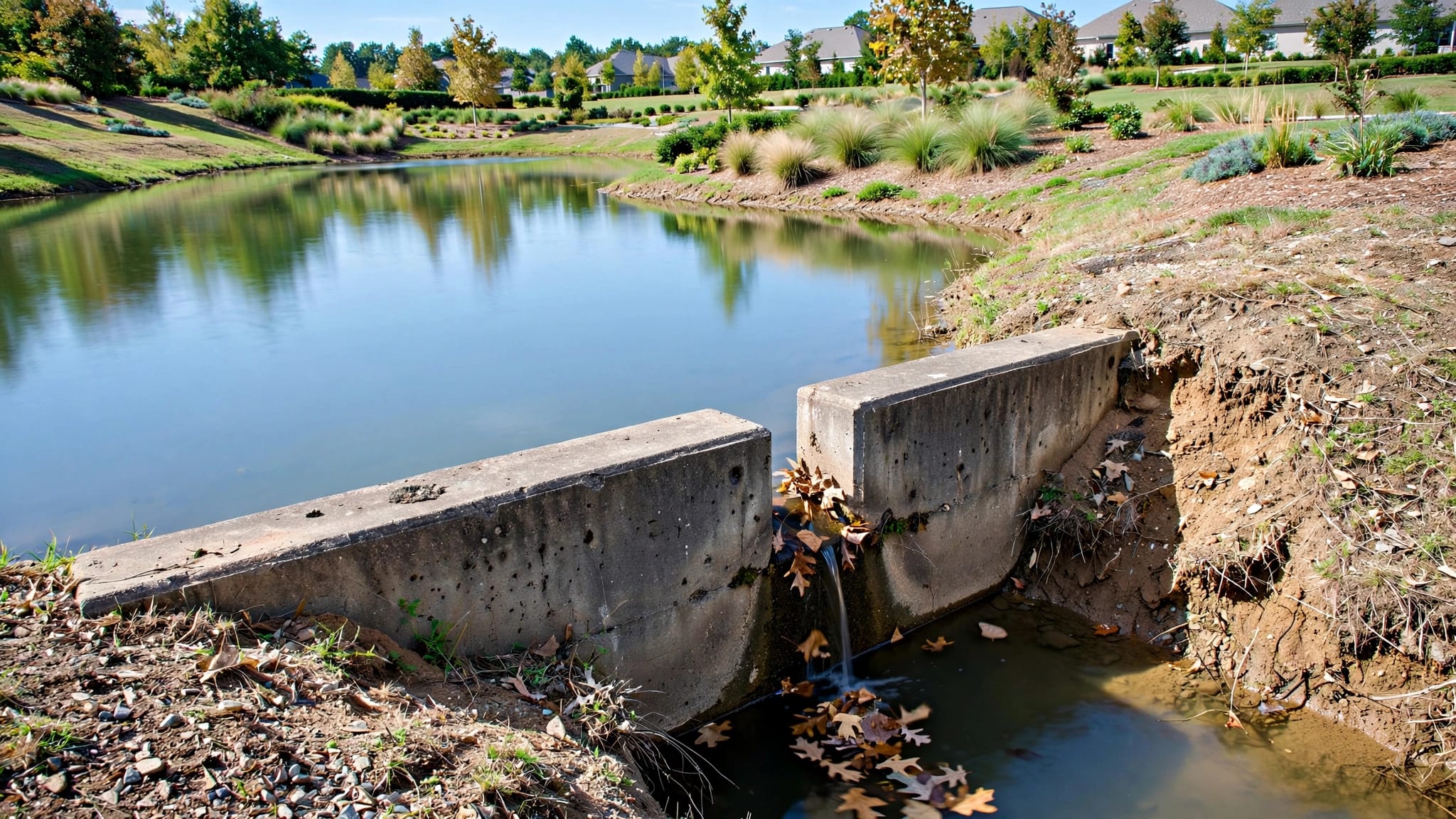
Water may move between basins through culverts, weirs, pipes, swales, or overflow structures. A shallow area in one lake can affect another if sediment blocks a connection or changes the way stormwater moves.
The relationship between these structures and lake conditions deserves close attention. Learn more about managing water flow in connected lakes when several basins show changing water levels, erosion, or algae after rain.
The survey team should record structure locations and note access limits. Depth readings near an outlet may differ from readings in the open basin, so the report should show where measurements occurred. Property managers can then match bottom conditions with maintenance records and stormwater complaints.
How the Fieldwork and Report Usually Work
A bathymetric survey begins with planning. The surveyor reviews the number of lakes, approximate sizes, water access, expected water levels, available plans, and the questions the owner needs answered. A project focused on dredging may require more detailed sediment information than a baseline depth map.
Field crews collect location and depth data
Many modern surveys use a depth sounder connected to GPS. A boat or other watercraft follows planned lines across the basin while the equipment records the position and depth of each reading. Crews may also take measurements by hand in small or difficult-to-access ponds.
Water level matters because depth is measured relative to the water surface. A report should state the water-surface elevation or the reference used for the survey. Without that information, two surveys can appear inconsistent even when the lake bottom has not changed.
Access and safety also affect the work. Dense vegetation, low bridges, narrow basins, soft banks, active golf play, and private community roads may require a tailored field plan. The owner should provide gate access and site contacts before the scheduled visit.
The report should answer management questions
A map alone doesn't tell a board what to do next. The written report should connect the readings to practical decisions, such as whether a lake needs more investigation, whether dredging targets a limited area, or whether a drainage structure requires inspection.
Ask the provider to explain:
- Which lakes and areas were surveyed.
- What equipment and reference elevations were used.
- How many readings were collected and how they were spaced.
- Whether the report includes water volume or sediment estimates.
- What limitations affected the fieldwork.
- Which findings require engineering, permitting, or construction review.
A clear report helps the property avoid paying for work that doesn't match the actual problem. It also creates a baseline for future comparison after dredging, shoreline repair, or major storm events.
Using Survey Results in an HOA or Golf Course Plan
The value of depth data comes from applying it to daily property decisions. Boards can use the findings to separate routine lake maintenance from larger capital projects. Golf course operators can coordinate lake work with irrigation, cart paths, play areas, and drainage access.
Build a lake-by-lake maintenance record
Keep the survey with site plans, inspection photos, treatment records, storm reports, and contractor invoices. Name each lake consistently in every document. That habit prevents confusion when a property has several ponds with similar shapes or names.
Routine maintenance still includes shoreline checks, aquatic weed and algae control, debris removal, water-quality observation, and inspection of outlets. A depth map helps staff notice changes that deserve a closer look, such as a growing shallow shelf or sediment accumulation near an inlet.
For multi-lake properties, a seasonal schedule can help match inspections to Florida's wet and dry periods. The Florida lake maintenance calendar provides a useful framework for planning inspections and follow-up work around changing rainfall and plant growth.
Ask contractors for a clear scope
When a survey leads to dredging, shoreline stabilization, or drainage repairs, request a written scope for each lake. The proposal should identify quantities, access assumptions, equipment, disposal responsibilities, restoration work, and any engineering or permit requirements.
Also ask for contractor qualifications. Aquatic treatment work and specialty construction involve different responsibilities, so the provider should state which license applies to each part of the work. Seabreeze Lake Maintenance holds Commercial Applicator License #CM28291 and State-Licensed Specialty Contractor #SCC131152136.
If the property has recurring algae, erosion, shallow areas, or unclear drainage conditions, Get a Free Lake Health Assessment to arrange a lake inspection and discuss the next step.
Conclusion
A multi-lake property needs a bathymetric survey when surface inspections no longer answer the questions behind its water problems. Sediment buildup, storm damage, recurring drainage issues, proposed dredging, and unexplained changes in water quality all justify better bottom data.
Survey each basin separately, document connected structures, and ask for a report that supports real maintenance and budgeting decisions. With that baseline in place, an HOA or golf course can respond to lake problems based on measured conditions instead of appearances alone.
Recent Posts